 Open access peer-reviewed chapter


Abstract
Faculty within the Arthur Temple College of Forestry and Agriculture at Stephen F. Austin State University are heavily involved with using drones to quantify and qualify forests and natural resources. Drones are involved across the entire curriculum within the College of Forestry and Agriculture to enhance the educational experience of all students. Emphasis is placed on integrating drones, and their effective use in forest and natural resource management endeavors, within all three main focus areas of teaching, research, and service. In addition to the traditional three education focus areas, faculty within the College of Forestry and Agriculture also help train future drone pilots as part of their educational experience.
Keywords
- drone
- forest
- natural resource management
- education
- drone pilot
1. Introduction
The use of drones is expanding in use within the natural resources community as a means to provide complex measurements of natural resources for teaching, research, and service activities. To produce foresters ready to be productive within society, they need to be effective at quantifying natural resources and have the ability to communicate this information clearly.
Natural resource education within the twenty first century, and the foreseeable future, must be relevant to the goals of society [1]. For natural resource managers, drones provide a useful tool when integrated into geospatial technologies to measure and predict forest and natural resources at the stand, forest, and landscape levels. Increasing a student’s skill level and educational knowledge while integrating math and statistics to analysis real-world natural resource-based situations is paramount in today’s world. Bridging the gap between a dedication to lifelong learning with necessary hands-on skills is of high importance.
Drones are relatively new to the process of acquiring data within the natural resources’ profession, and increased emphasis needs to focus on training students with this new technology. Upon graduation students need to be ready to engage with society and have the capacity to deal effectively with the complex economic, political, ecological and social issues natural resource managers deal with every day. Natural resource graduates must be prepared to enhance the health of the natural resource environment through sustainable management, conservation, and protection of earth’s resources. As technology and drones continue to change and evolve, educators need to adjust and adapt their teaching methods to meet these new societal challenges [2, 3].
Within the Arthur Temple College of Forestry and Agriculture (ATCOFA) at Stephen F. Austin State University (SFASU) there are four faculties dedicated to the integration of drone technology across the entire curriculum. The four faculties are collectively called the “Drone Squad” as they focus their teaching, research, and service activities on using drones to effectively quantify and qualify forests and natural resources. The goals of the faculty are to meet the college’s mission objectives of making a difference, work outdoors, while using high-end technology.
Drones, and the imagery they collect, are increasing in popularity and use and are the future of remotely sensed data acquisition. Drones allow you to acquire the imagery and videos of what you want and when you want it collected. In addition, one of the most appealing aspects of using a drone to acquire remotely sensed data is that the user controls the spatial, spectral, radiometric, and temporal resolution of any data collected for forest composition, structure, volume and growth [4, 5].
Historically foresters and natural resource managers have relied on satellite-based platforms for imagery. Although effective at the landscape level, satellite-based platforms with their traditional poor spatial resolution have been ineffective in providing high spatial resolution data for visual interpretation at the individual tree level. Drones with their high spatial resolution controlled by the user can identify individual trees and plant species. In addition to providing a traditional nadir or 90-degree angle perspective, drones can be flown interactively and with a movable camera that can also provide the user with off-nadir or side perspectives of earth surface objects such as the side of a tree which can be very useful in tree stem assessments.
The objective of this chapter is to present the reader how drones can be integrated across a natural resource-based curriculum to increase a student’s skill set. Examples of how drones are integrated across the curriculum at SFASU are presented within the context of the three main focus areas of an academic institution being teaching, research, and service endeavors. Finally, a fourth focus area demonstrates that SFASU faculty are heavily involved with training current students to be Federal Aviation Administration (FAA) certified drone pilots.
2. Teaching–Integration within ATCOFA classes
Drones are integrated across the entire curriculum within ATCOFA with a focus on forests and natural resource management activities [4]. Specific examples are given that highlight how effective drones can be to quantify and qualify natural resources, which gives the reader a perspective on how broad the applications can be in the real world.
For example, drones can be used to fly a recreational hiking trail to visually highlight the trail for individuals not able to physically walk the trail themselves or to document the need for trail maintenance in the future (Figure 1, Video 1, https://bit.ly/3tYlx3U).
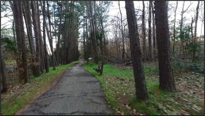
Figure 1.
Example of a drone flying and recording a hiking trail in east Texas.
In Figure 2, drones are used to capture and record the felling of a tree on the SFASU campus as an aid to help forestry students understand the complex nature of felling a diseased tree within an urban forestry setting (Video 2, https://bit.ly/3tYlx3U). In this particular example, a drone was used to record the felling of a limb as part of a classroom exercise.
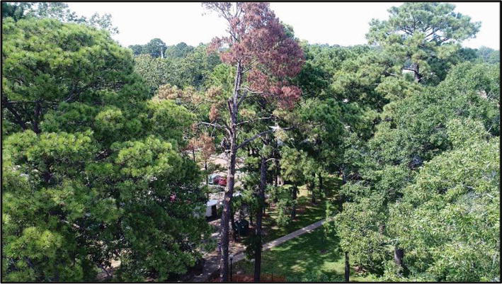
Figure 2.
Drone capturing the felling of a diseased tree limb.
Part of the goal of ACTOFA is to provide interactive outside demonstrations for students visiting the SFASU campus to get them excited about college and natural resource management as a future possibility. Figure 3 demonstrates the ATCOFA college dean talking with prospective students about the benefits of a natural resource-based education. This drone video was taken for future recruitment of undergraduate students (Video 3, https://bit.ly/3tYlx3U).
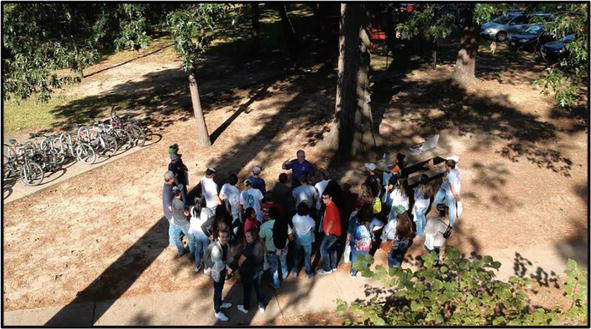
Figure 3.
Drone video of an interactive outside natural resource demonstration.
An important component of curricula within ATCOFA is the wildlife major where students study wildlife science. Drones can be an effective tool in helping to quantify and identify wildlife species from a distance that might not be approachable in person. Figure 4 demonstrated the use of drone imagery to quantify turtles within a local creek in Nacogdoches, Texas (Video 4, https://bit.ly/3tYlx3U).
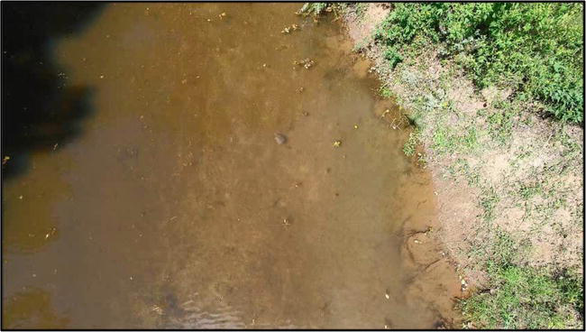
Figure 4.
Counting turtles in LaNana Creek, Nacogdoches, Texas.
An additional component of the education received by the students within ATCOFA, and highly praised by the faculty and future employers, is the ability of the faculty to introduce students to ecosystems and experiences they typically do not receive on campus. To that end, faculty travel the country and record drone imagery of different locations to enhance a student’s educational experience. In Figure 5, faculty recorded and embedded in course work an example of a beaver dam that was destroyed by early spring snow runoff in northern Utah (Video 5, https://bit.ly/3tYlx3U).
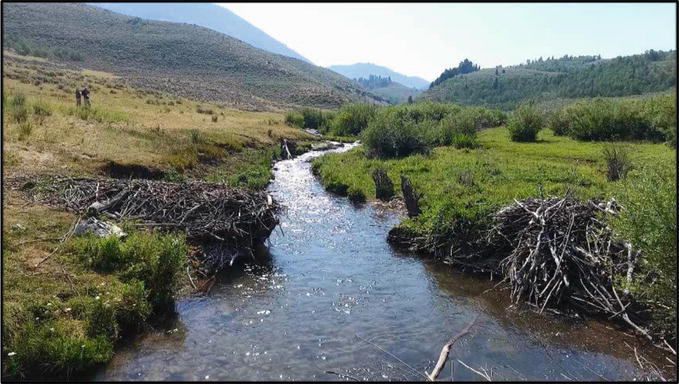
Figure 5.
Beaver dam destroyed by snow run off in northern Utah.
For foresters, especially in their undergraduate education, it is important to not only understand trees but the conditions of the forest floor. Figure 6, a video of Kamiak Butte in eastern Washington state north of Pullman, Washington, shows the influence of the forest floor in an arid intermountain ecosystem (Video 6, https://bit.ly/3tYlx3U).
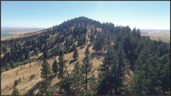
Figure 6.
Forest floor evaluation on Kamiak Butte, Washington.
In addition to wildlife majors within ATCOFA, the faculty also teach a number of outdoor recreation students involved with natural resource management activities. Figure 7 was collected by faculty to demonstrate the conditions of recreational sites across the United States to demonstrate not only how they vary from location to location, but also their similarity (Video 7, https://bit.ly/3tYlx3U). Figure 7 demonstrates a recreation site within Scenic Beach State Park in western Washington about an hour west of Seattle.
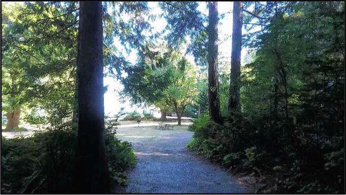
Figure 7.
Recreation site within Scenic Beach State Park, Washington.
For the traditional foresters with ATCOFA, it is paramount that they not only understand trees and forest ecosystems but that they also understand open range ecosystems typical of the western United States. Figure 8 was collected to demonstrate open range conditions and the sparseness of vegetation in the arid western United States that students cannot be introduced to on the campus of SFASU. Figure 8 demonstrates a video that displays the vegetation distribution of open range in the Unita-Wasatch-Cache National Forest in northern Utah (Video 8, https://bit.ly/3tYlx3U).
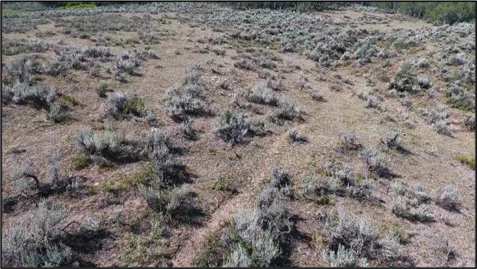
Figure 8.
Range assessment in northern Utah.
Figure 9 demonstrates a video obtained of the Hell Roaring Creek fire in central Idaho within the Sawtooth National Recreation Area. This particular imagery was flown to demonstrate to the ATCOFA forestry students the damaging effects of fire within a Lodgepole Pine ecosystem (Video 9, https://bit.ly/3tYlx3U).
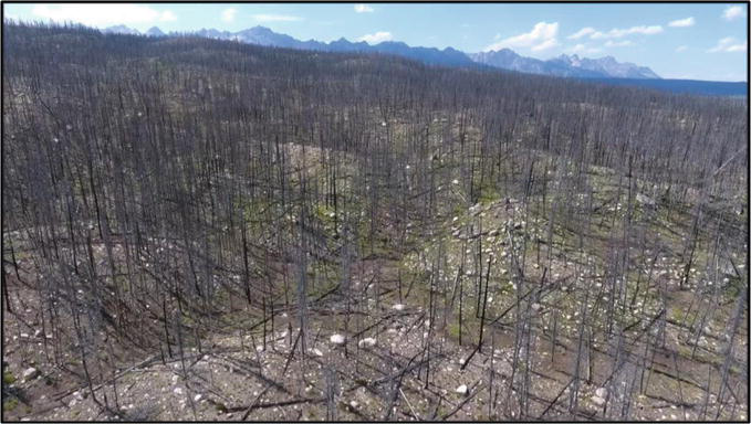
Figure 9.
Fire damage within a Lodgepole Pine ecosystem.
Figure 10, also flown for our forestry undergraduate students, demonstrates the uniqueness of Aspen trees relative to other conifer trees within a forest ecosystem. Aspen trees grow in clumps relative to other trees within an ecosystem, which can be readily seen from a spatial perspective giving students a unique perspective when trying to identify individual tree species with a forested landscape (Video 10, https://bit.ly/3tYlx3U).
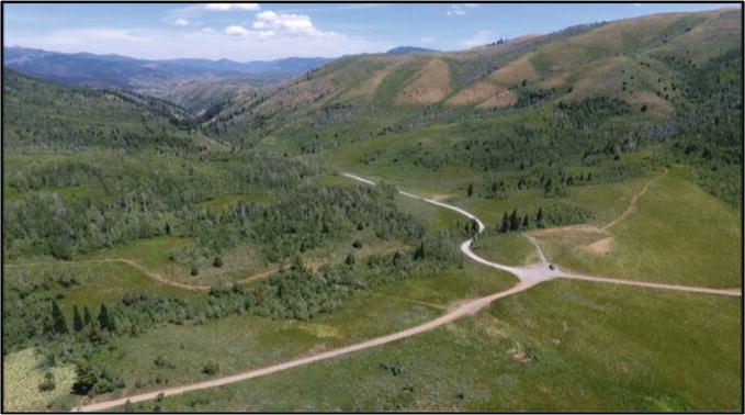
Figure 10.
Aspen trees with a forest landscape in northern Utah.
While introducing our outdoor recreation majors to different recreation sites across the United States, it is important to capture imagery from different ecosystems. Figure 11, in contrast to Figure 7, depicts a recreation site within the Sawtooth National Recreation Area in central Idaho. This area represents an arid intermountain location different from the recreation area depicted in Figure 7. This image represents a recreation site on the shore of Pettit Lake south of Stanley, Idaho in the Sawtooth National Forest (Video 11, https://bit.ly/3tYlx3U).
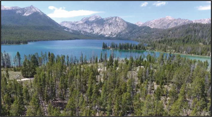
Figure 11.
Recreation site on the shore of Pettit Lake, Sawtooth National Forest.
Another important component of a forestry education in the United States is for students to understand the effect of beetle damage on a forest. Figure 12 depicts the effect of mountain pine beetle,
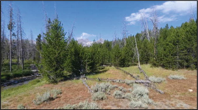
Figure 12.
Lodgepole pine beetle damage, Sawtooth National Forest.
Figure 13 shows our undergraduate students a recreation site on the Snake River south of Jackson, Wyoming. The video shows a popular recreation activity in the western United States, river rafting, which our students cannot experience in east Texas (Video 13, https://bit.ly/3tYlx3U).
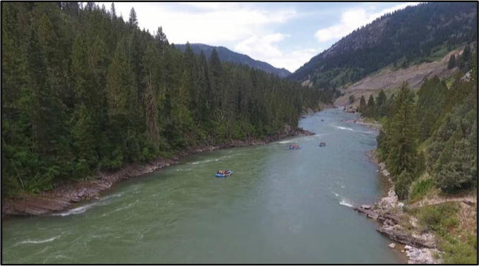
Figure 13.
River rafting on the Snake River south of Jackson, Wyoming.
Our recreation students are also interested in historical artifacts and buildings scattered throughout our forests (Figure 14). Not only in their preservation, but in their education as a means to help others understand the importance of historical artifacts. This video was flown to introduce our students to typical historical dwellings found within forests of the United States, in this particular case an historical cabin, that exists within the Stanley Basin in central Idaho (Video 14, https://bit.ly/3tYlx3U).
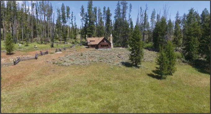
Figure 14.
Historic cabin deep within the Stanley Basin in central Idaho.
Figure 15 is an important video that was flown to introduce our spatial science students to the effects of light interaction on the landscape and its effect on vegetation distributions. This is a drone video of Spawn Creek within Logan Canyon of northern Utah. It was flown to demonstrate the effect of intense solar radiation by drying out one side of a southerly exposed hill side versus a more shaded hill side (Video 15, https://bit.ly/3tYlx3U), emphasizing the importance of aspect in plant growth.
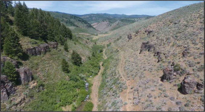
Figure 15.
Effects of solar radiation on vegetation distributions.
Our last example of a drone video flown for teaching purposes depicts an image of the Sawtooth National Recreation Area (Figure 16). This was acquired to introduce our students to the effects of fire from a nadir or birds-eye perspective for the ease of quantifying downed timber as a result of a recent forest fire (Video 16, https://bit.ly/3tYlx3U).
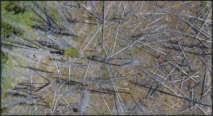
Figure 16.
Forest floor post fire assessment.
3. Research–Quantifying natural resources
In addition to integrating drones into the curriculum, faculty also are heavily involved in drone related research projects. Research has involved many facets of drones and their uses, with an emphasis on how to best use drones in quantifying forests and natural resources.
Figure 17 shows the results of a research project utilizing drone imagery to produce a 3D model of the landscape [6]. The results of 3D modeling can be used to visually portray a landscape to aid in the visual assessment of natural resources.
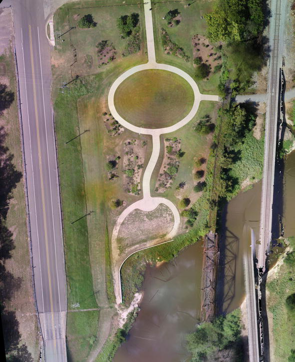
Figure 17.
Example of 3D landscape modeling.
Another factor our forestry students are concerned about is insect damage on a forest. Many research projects within ATCOFA have involved using the high spatial resolution of drone acquired imagery to assess insect damage at a level of detail not attainable by traditional satellite-based platforms. Figure 18 is an example of using drone imagery undertaken by faculty within ATCOFA to assess the impact of forest damage due to the
Figure 18.
In addition to using drone imagery to create 3D models of the landscape, drones can be used to research their effectiveness at creating 3D models of human created earth surface features and their impact on the natural resource ecosystem. Figure 19 portrays ATCOFA research looking into the effects of human created surface features and building on the surrounding environment from a visual perspective.

Figure 19.
Using 3D terrain modeling to assess a natural resource environment.
Figure 20 portrays current research on the campus of SFASU involving the spatial distribution of litter on campus. High spatial resolution drone imagery was flown to not only quantify litter on the SFASU campus, but to model the spatial distribution as an aid to increase awareness of the litter problem on campus in an effort to minimize its negative impact on the environment and to plan litter clean up.
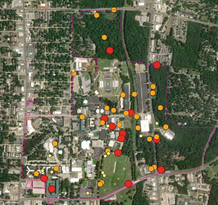
Figure 20.
Hazard rating litter on the campus of SFASU.
One of the most important aspects of using drones is to combine individual drone images together to create an orthophoto mosaic of an area. By acquiring drone images over a study area with sufficient overlap and side lap, the individual drone images can be stitched together to create a highly accurate composite image or orthophoto mosaic. Considerable research has been undertaken by faculty within ATCOFA to assess the accuracy of drone created orthophoto mosaics and have found that drone created orthophoto mosaics are highly accurate and can be used as base maps in geospatial science related products with a high degree of accuracy and confidence (Figure 21) [7, 8].
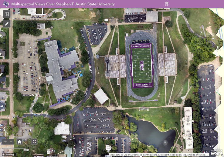
Figure 21.
Orthophoto mosaic created of the campus of SFASU.
Figure 22 depicts a research project assessing the utility of using drone imagery to hazard rate urban trees for disease and infestations. Traditionally this has been obtained from the ground using a visual assessment, but drone imagery allows the user to acquire imagery closer than obtainable from the ground and from angles not previously attained. ATCOFA research has shown that drones can provide accurate tree hazard rating equal to or better than traditional field assessments and in a timely and efficient manner (Figure 22) without significant differences [9].
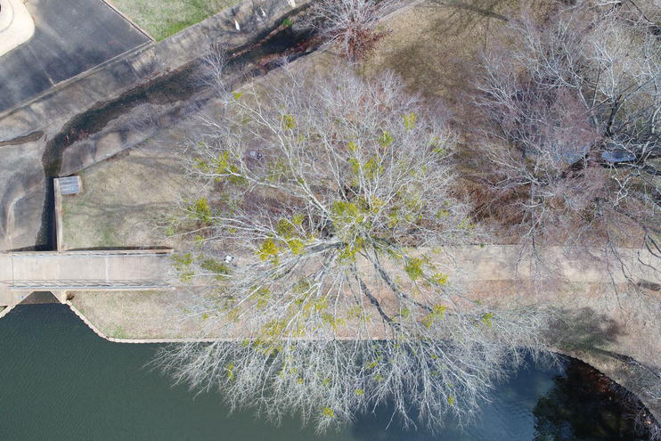
Figure 22.
Assessing tree hazard with a drone.
The last research project presented in this chapter, which is portrayed in Figure 23, shows the use of change detection methodology employed to identify landscape change overtime. This particular project used current drone imagery compared to an historical creek in Nacogdoches, Texas digitized from 1939 historic aerial photographs to identify the location of current landscape features relative to the location of the historic creek bed locations. This drone research project shows how current high-end technology can be merged with historical data to provide new insights and implications for current natural resource management perspectives.
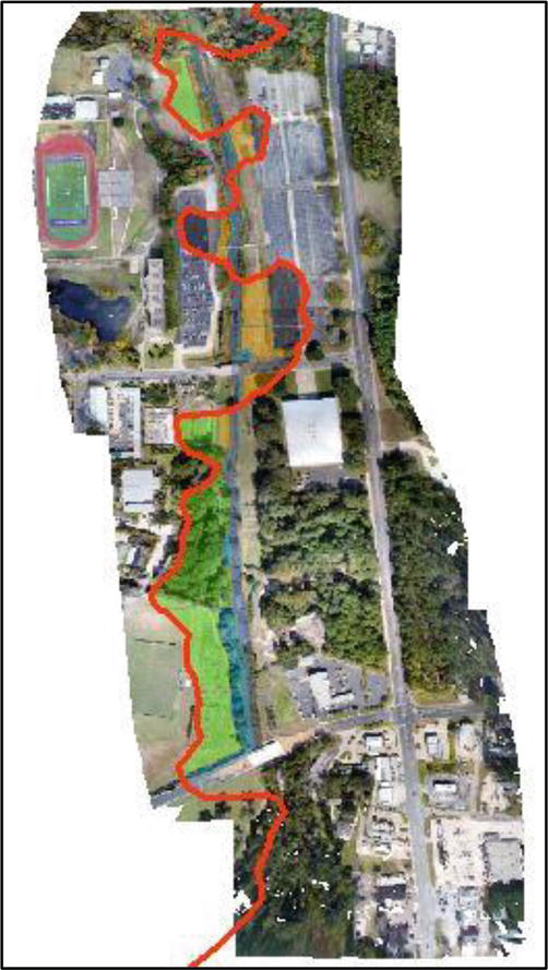
Figure 23.
Drone imagery merged with an historic creek river channel.
4. Service–Local, state, and the world
In additional to traditional teach and research activities, faculty within ATCOFA also integrated drone technology into service project benefiting local communities and society in general [6, 10]. Faculty in ATCOFA have found the use of drones to be a useful took in aiding local communities acquire useful and pertinent information.
Figure 24 depicts a local service project where the faculty flew a drone to create an orthophoto mosaic for a local park in Lufkin, Texas. The drone was flown to acquire individual drone images that were then utilized to create a highly accurate orthophoto mosaic for the city park. The city of Lufkin, Texas will use the created orthophoto mosaic in future planning activities for proposed expansion of an existing zoo adjacent to the city park [8, 11].
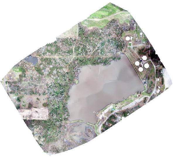
Figure 24.
Orthophoto mosaic of a city park in Lufkin, Texas.
The campus of SFASU has recently begun the demolition and construction of various buildings on campus. As an aid to the campus community, faculty and graduate students within ATCOFA have begun to fly the demolition and construction of various buildings on campus. Goals are to not only to provide visual documentation of the demolitions and reconstruction, but to demonstrate to students on campus of the utility of using drones to document urban change (Figure 25).
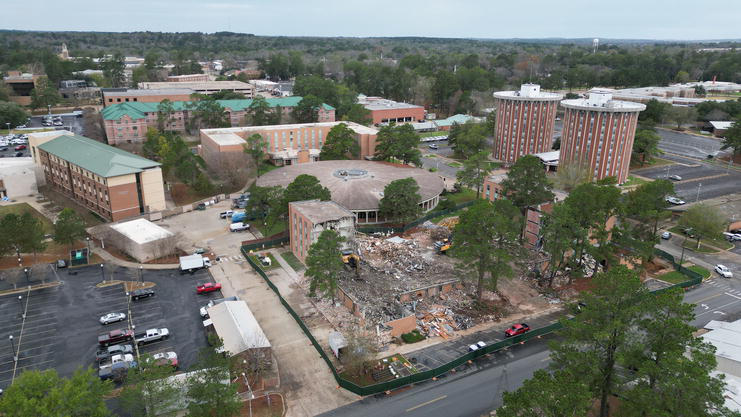
Figure 25.
Hall 16 demolition on the campus of SFASU.
A recent service project undertaken by the faculty within ATCOFA was to partner with the ROTC program on the SFASU campus to demonstrate the utility of drone acquired imagery for use with tactical training of Army officers within the ROTC program. Faculty traveled with the ROTC staff to a recent training site and aided their training by providing real time imagery to officers in training to demonstrate the utility of real-time battle field imagery. Faculty were paired with individual ROTC cadets with a drone to provide them with real-time imagery of a battlefield to aid their preparation and battlefield assessments (Figure 26).
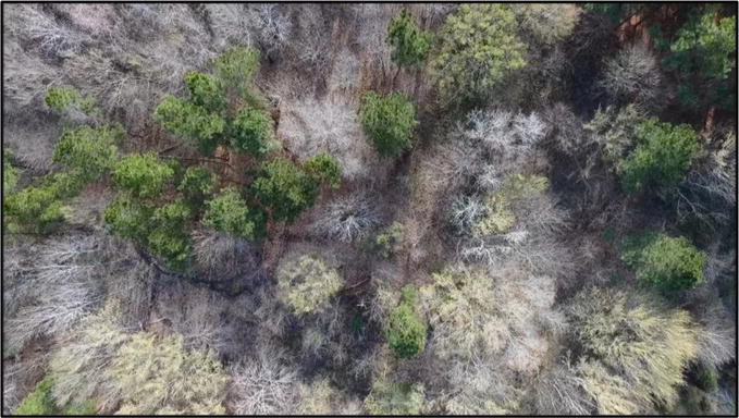
Figure 26.
ROTC field exercise–hidden soldiers at base of trees.
5. Training future drone pilots
The fourth focus area faculty are heavily involved with at SFASU involves training students in not only how to use drones to effectively quantify and qualify forests and natural resources, but to train individual students to be FAA certified drone pilots [4, 12]. Thereby, increasing their skill level and employment prospects upon graduation.
ATCOFA faculty closely follow FAA guidelines while training student drone pilots. Faculty merge the process of physically flying drones with traditional classroom education on drone pilot rules and regulations. Our university recently added a course on drones and Geographic Information Systems (GIS) and the use of drones continues to be integrated across the curriculum. The faculty’s intent was to introduce students to the use of high-end technology within the natural-resource-based decision-making process [4, 12].
A drone’s unique ability to acquire remotely sensed aerial imagery and videos of natural resources at the time and place of the user’s control is one of the main advantages of using a drone in the field. The user, rather than relying on traditional satellite-based imagery which has been the mainstay of remote sensing since 1972, can now control the spatial, spectral, radiometric and temporal resolution of data needed for a particular natural resource.
By integrating multiple different digital images obtained with a drone, the user can now create their own orthophoto mosaic of a geographic area in a few hours while controlling the spatial environment of the mosaic product. To create a mosaic project, the drone is unpacked and assembled in a matter of minutes, then the project is defined with a user-controlled application following which the drone imagery are obtained with an app. The images are eventually downloaded using drone-specific software to create an orthophoto mosaic. For a geographic area encompassing 30 ha, the process can take less than 3 hours from start to completion [4].
Before students can fly a drone, a four-step process was developed as part of a Mentored Undergraduate Scholarship program at Stephen F. Austin State University [4]. Successful operation of a drone was based on a four-part process that included three intermediate steps culminating in a capstone focus at the end. The three intermediate steps represented first learning how to assemble a drone, second involved learning how to complete a controlled drone flight, and the third step involved learning how to use a drone to obtain three multiple points of measurements from both imagery and video. The culminating capstone at the end involved learning how to synthesize drone information and knowledge to properly quantify and qualify natural resources ([4], p. 403).
For intermediate step 1, the operator has to assemble the drone ready for flying, then pass a safety inspection by the instructor. For intermediate step 2, the pilot needed to demonstrate how to pilot a drone and successfully record an image and video. For intermediate step 3, the drone operator needed to download images and videos into geospatial science software to effectively quantify natural resources. For the capstone assessment, the pilots needed to demonstrate the application and user of drone acquired imagery and video into specific natural resource assignments. As a final capstone assessment, drone operators demonstrating proficiency in flying the drones were allowed to complete the FAA drone pilot examination to become a certified drone pilot [4].
With the ever-increasing use of more user-friendly drones, more compact size and lower prices, drone use in natural resource management will only continue to exponentially increase. Early student exposure and instructor led hands-on use of drones will develop the skill sets defined by Bullard et al. requiring the integration of technology with a traditional education [2, 3]. Drones allow this integration by permitting the user to acquire accurate information on forest composition, structure, volume and growth [6]. To meet these society goals, emphasis within ATCOFA is being placed on expansion of drones across the entire curriculum [4, 6, 12].
With increased emphasis on hands-on use of drones within ATCOFA, increased focus is place on service-learning activities [13]. Focus areas include being attentive to the community partner’s mission and vision; understanding the human dimension of a community’s work focus; being aware of a communities limited resources; accepting and sharing inefficiencies that limit productivity; considering the impact of lifelong agreements; and most importantly viewing the need to continue of progress as important [14].
These six focus areas were integrated into teaching, research and service with drones in the development of service-learning activities for the Port Jefferson History Center and Nature Center on use of drones in documenting the natural resource aspects of the site [6, 15]. In addition, a three-dimensional model of the Caddo House destroyed by a tornado was recreated as a remembrance of the event for the Caddo Nation celebration (Figure 27) [16]. Hands-on activities which included the estimation of heights of trees, buildings and light poles using drones were constructed in multiple natural resource courses (Figure 28) [10, 12, 16]. The major finding was that the drone needed to land and be reset between individual drone flights to acquire more accurate measurements. Repeated drone measurements of the same area over time indicated positional accuracy was highest at the center of the orthophoto mosaic compared to edge effects with increased overlap (Figure 29) [7, 17]. Drone use has also been emphasized in citizen science communication incorporating natural resource management endeavors [18].
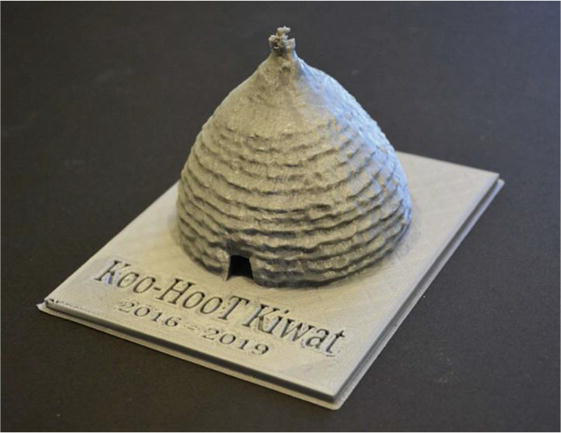
Figure 27.
3D model of Caddo House destroyed by a tornado.
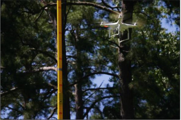
Figure 28.
Using a drone to estimate height accuracy [
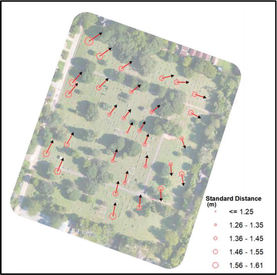
Figure 29.
Map of mean center locations with the magnitude of precision presented as the standard distance.
6. Conclusions
The integration of hands-on training in the use of drones emphasizes the mission of the Arthur Temple College of Forestry and Agriculture to produce “society ready” natural resource managers while maintaining excellence in teaching, research and service to enhance the health and vitality of the environment through sustainable management, conservation and protection of our forests and natural resources to promote the production and economic vitality of natural resources. The land ethic of work outdoors, make a difference and use high-end technology is enhanced through the use of drones as the students must use safe techniques and follow FAA regulations of UAS operation. The four-step process of drone assembly; controlled flight using a Pilot in Command and a Visual Observer; preparation of an orthomosaic using the proper applications and training; and the synthesis of drone information across landscapes, prepares students for safe and productive drone missions. To date, 30 students have taken and passed the FAA Unmanned Aerial System Pilot exam and taken the FAA TRUST test. The increase complexity and multitude of sensors of the drones means increased training and readiness for successful drone pilots.
Acknowledgments
The authors with to acknowledge the many students over the years who have participated in learning how to use drones to map, manage, and monitor forests and natural resources. It is through your valuable contribution and love of learning that has made the validation of introducing drones within the ATCOFA curriculum a success. This work was supported by McIntire Stennis funds administered by the Arthur Temple College of Forestry and Agriculture and a Center for Applied Research and Rural Innovation grant from Stephen F. Austin State University.
References
- 1.
Bullard SH. Forestry curricula for the 21st century—maintaining rigor communicating relevance, building relationships. Journal of Forestry. 2015; 113 :552-556. DOI: 10.5849/jof.15-021 - 2.
Bullard SH, Stephens Williams P, Coble T, Coble DW, Darville R, Rogers L. Producing “society-ready” foresters: A research-based process to revise the bachelor of science in forestry curriculum at Stephen F. Austin State University. Journal of Forestry. 2014; 112 :354-360. DOI: 10.5849/jof.13-098 - 3.
Bullard S, Coble D, Coble T, Darville R, Rogers L, Stephens Williams P. Producing “Society-Ready” Foresters: A Research-Based Process to Revise the Bachelor of Science in Forestry Curriculum at Stephen F. Austin State University [ATCOFA Monograph 1-2014]. Nacogdoches: Arthur Temple College of Forestry and Agriculture, Stephen F. Austin State University; 2014 - 4.
Unger DR, Kulhavy DL, Hung I-K, Zhang Y, Stephens WP. Integrating drones into a natural-resource curriculum at Stephen F. Austin State University. Journal of Forestry. 2019; 117 :398-405. DOI: 10.1093/jofore/fvz031 - 5.
Tang L, Shao G. Drone remote sensing for forestry and research and practices. Journal of Forest Research. 2019; 26 :791-797. DOI: 10.1007/s11676-015-0088-y - 6.
Kulhavy DL, Unger DR, Grisham R, Coble D, Endsley G, Gannon M. Service learning for the Port Jefferson History and Nature Center: Senior capstone forestry course. Journal of Community Engagement & Higher Education. 2017; 9 :67-79 - 7.
Hung I-K, Unger D, Kulhavy D, Zhang Y. Positional precision analysis of orthomosaics derived from drone captured aerial imagery. Drones. 2019; 3 :Article 46. DOI: 10.3390/drones3020046 - 8.
Williams V, Unger DR, Kulhavy D, Hung I-K, Zhang Y. Comparing Drone2Map versus Pix4Dmapper when creating orthophoto mosaics over homogeneous land features. International Journal of Geospatial and Environmental Research. 2023; 10 :Article 2. Available from:https://dc.uwm.edu/ijger/vol10/iss1/2/ - 9.
Kulhavy D, Unger D, Hung I, Zhang Y. Comparison of AR.Drone quadcopter video and the visual CTLA method for urban tree hazard rating. Journal of Forestry. 2016; 114 :517-523. DOI: 10.5849/jof.15-005 - 10.
Unger DR, Hung I-K, Zhang Y, Kulhavy DL. Integrating drone technology with GPS data collection to enhance forestry students interactive hands-on field experiences. Higher Education Studies. 2018; 8 :49-62 - 11.
Unger DR, Hung I-K, Kulhavy DL, Zhang Y, Busch-Petersen K. Accuracy of unmanned aerial system (drone) height measurements. International Journal of Geospatial and Environmental Research. 2018; 5 :Article 6. Available from:https://dc.uwm.edu/ijger/vol5/iss1/6/ - 12.
Unger D, Kulhavy D, Busch-Petersen K, Hung I-K. Integrating faculty led service learning training to quantify height of natural resources from a spatial science perspective. International Journal of Higher Education. 2018; 5 :104-116 - 13.
Tinkler A, Tinkler B. Teaching across the community: Using service learning field experiences to develop culturally and linguistically responsive teachers. In: Jagla VM, Erickson JA, Tinkler AS, editors. Transforming Teacher Education Through Service Learning. Charlotte, NC: Information Age Publishing; 2013. pp. 99-117 - 14.
Latorre-Navarro E, Meier E. Strategies to fund community service capstone projects 2022 In: Capstone Design Conference; 6-8 June 2022; Dallas. 2022. p. 2. Available from: https://www.capstonedesigncommunity.org/sites/default/files/proceedings_papers/LatorreNavarroMeier_FundingCommunityServiceProjects_CDC22.pdf - 15.
Zhang Y, Kulhavy D, Gerland J, Hung I-K, Unger D, Wen X, et al. Evaluating different UAS flight methods for 3D model generation and printing of a tornado destroyed cultural heritage: Caddo House in Texas. Drones and Autonomous Vehicles. 2023; 1 :10003. DOI: 10.35534/dav.2023.10003 - 16.
Kulhavy DL, Hung I-K, Unger DR, Viegut R, Zhang Y. Measuring building height using point cloud data derived from unmanned aerial system imagery in an undergraduate geospatial science course. Higher Education Studies. 2021; 11 :105-113 - 17.
Wiliams V, Unger D, Kulhavy D, Hung I-K, Zhang Y. Assessing drone mapping capabilities and increased cognitive retention using interactive hands-on natural resource instruction. Higher Education Studies. 2023; 13 (2):28-36 - 18.
Kulhavy D, Unger D, Hung I-K, Schalk C, Zhang Y, Viegut R. Integrating natural resources education through the use of unmanned aerial systems (drones). International Journal of Higher Education. 2022; 11 :143-152